Thawing permafrost
Although satellite imaging makes it possible to collect data over a wide area, the study of permafrost from space is limited as it provides only data related to the surface. For that reason, permafrost observations are based primarily on field data, particularly when it comes to deep measurements. This has the disadvantage of causing variations in the distribution of measurements due to the size of the area. The data is therefore insufficient to assess the scope and extent of permafrost thawing. As a result, the observed trends on the impact of climate change are limited.
Figure 4 : Map showing the various permafrost measurement stations in northern Quebec. (From: Centre d’études nordiques, undated).
Observations
However, it is known that the permafrost boundary has migrated 130 km to the north in 70 years. This is expected to continue due to increased winter precipitation in the form of rain and rising temperatures. These factors have accelerated permafrost thawing and will continue to do so.
In addition, in Nunavik, where measurements at some sites began in 1990, the data shows that the permafrost is warming by 0.1°C to 1.0°C per decade.
Figure 5 : Time series showing soil temperatures in Kangiqsualujjuaq between 1991 and 2018. The green lines correspond to permafrost 10 m deep, while the yellow and red lines correspond to permafrost 15 m and 20 m deep, respectively. (From: Centre d’études nordiques, 2020) Note that the cooling in 2017 corresponds to a year when the average annual temperature in the region was colder than usual (Climate Portraits).
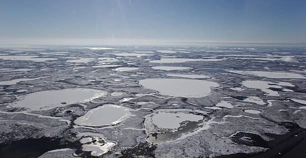
Aerial photos and satellite imagery have shown that permafrost mounds on the surface are decreasing and the number of thermokarst lakes is increasing in northern Quebec. These changes reflect the initiation of the thawing process in these regions.

Image : Thermokarst lake. Source
Definition | Thermokarst lake
A thermokarst lake is a periglacial phenomenon - that is, a phenomenon occurring close to glacial regions - characterized by depressions in the terrain due to the melting of underground ice.